Did you miss this talked-about session from the Annual Conference? Here’s your chance to catch it! Join us to hear from @Thompgri about his incredible project.
Abstract
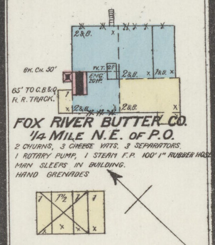
Planning agencies have begun to incorporate the concept of a Digital Twin, recognizing their ability to visualize spatial trends and processes. Utilizing Sanborn Fire Insurance Maps, this project attempts to further integrate historical modeling into digital twins, giving viewers an unprecedented look into the past and bringing archival maps 'back to life’ with GIS!
Through this workflow, a 3-D model created showing Cairo in different eras, along with historical zoning maps, and other historical geo-analyses (i.e. food source accessibility).
By focusing on Cairo, Illinois, this project shows how historical digital models can visualize the changing urban geomorphology of a city in decline - potentially shedding greater light on the processes at work. Though ostensibly a “northern city”, this research also uses GIS to analyze spatial segregation in the early 1900s by identifying churches, schools, and dwellings identified as African American in the Sanborn maps.
These maps can be further enhanced by using local, county, or state historical archives - particularly phonebooks and newspapers - to identify home and business owners in different eras.
This will share more about the process of creating 3-D historical models, as well as discussing some of the findings specifically related to Cairo. While the city’s national standing has certainly diminished over recent decades, Cairo remains integral to American westward expansion, and it embodied many of the Civil Rights struggles of the 1960s. With this process, GIS can share a unique perspective on urban areas prior to the rise of satellite or aerial imagery.